Path 1: Village - Punta Troia
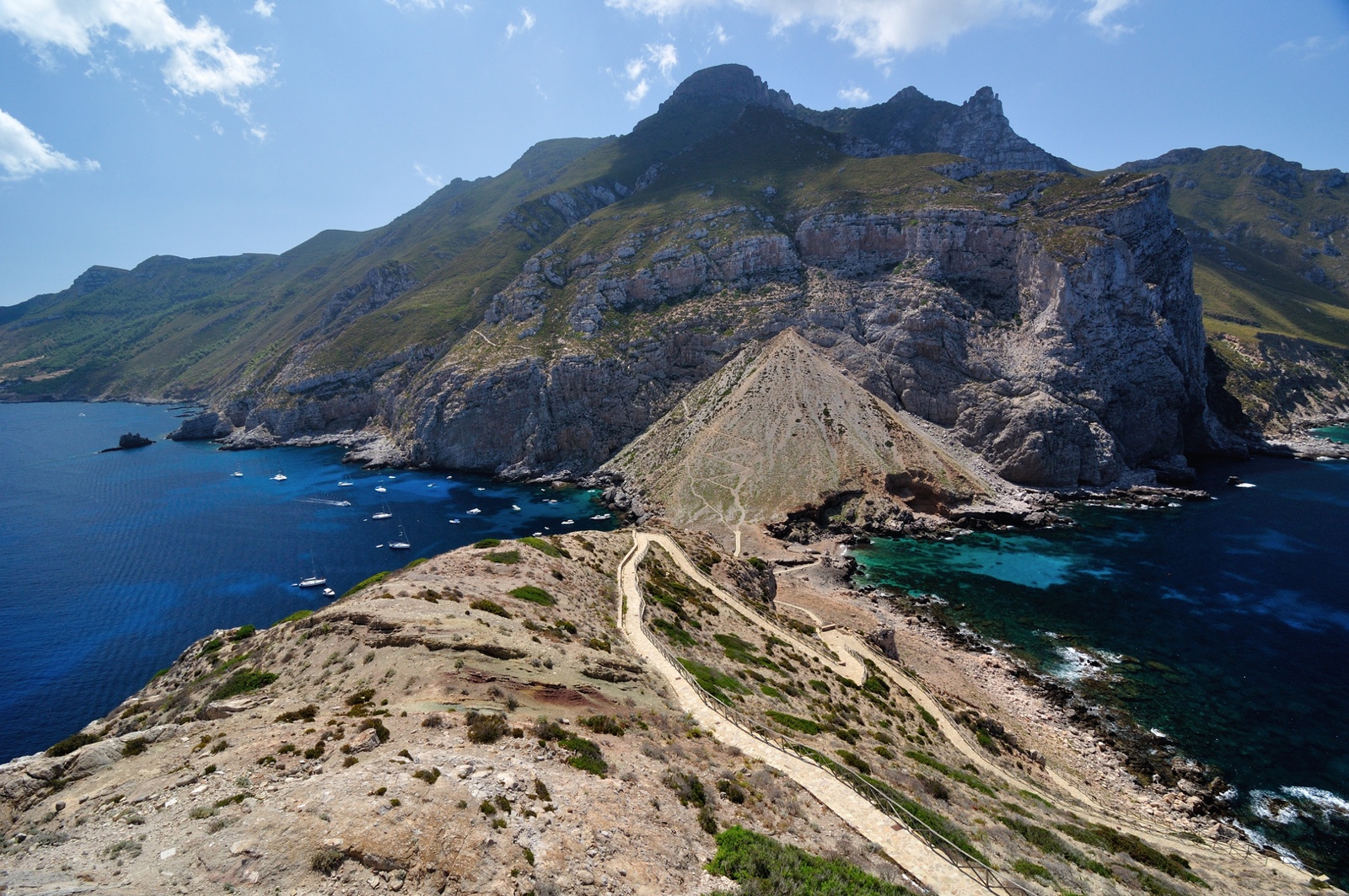
The path, a favourite with tourists and very popular in summer, winds along a beaten, paved path and, in some sections, bordered by beautiful cistus, heather, rosemary and myrtle bushes. From the old pier, a pleasant up and down along the coast, until you come to two drinking water fountains and a natural spring, near some native pines. Having passed the Camel rock, in front of which the cave of the same name opens up, the path descends towards the isthmus that allows you to reach the promontory of Punta Troia and its castle. To the north is the beach of Scalo Maestro, sheltered from the sirocco and libeccio currents, and to the south Cala Manione, sheltered from the mistral and west winds. One arrives at the castle, facing an uphill slope, demanding especially if travelled under the sun. There is a beautiful view of the east coast of the island and, in the background, Favignana and Levanzo.
Typical vegetation: Mediterranean scrub with a prevalence of mastic trees, Senecio cinerario, Cisto incanus, helichrysum, lonicera, Aleppo pine, Erica arborea.
| Route: | Pedestrian |
| Difficulty: | Intermediate |
| Distance: | 4 km |
| Time: | 80 min |
| Altitude difference: | 240 m |